CLIMATE CHANGE IMPACTS
Sea-Level Rise
What is sea level rise?
Sea level rise refers to the rise in water level relative to the land. The local impact of sea level rise depends on the slope and topography of the land. In areas of steep terrain, the shoreline may move little. In low-lying areas, a rise in sea level can move the shoreline a significant distance inland.
What causes sea level rise?
Sea level rise is caused by several factors:
- Because of warmer temperatures, ice sheets such as the one covering Greenland as well as mountain (or alpine) glaciers are melting. This increases the amount of water entering the world’s oceans and causes the sea level to rise.
- When water gets warmer, it expands. Because warmer water takes up more space, the sea level rises.
- Since the last ice age, much of Atlantic Canada has been experiencing a process called subsidence. The weight of the continental glacier that covered most of Canada during the last ice age caused the edges, including the Atlantic coastal areas, to tilt upward. Now that the glacier is gone, the centre of the continent is slowly rising as it returns to its previous level. This is causing Atlantic coastal areas to sink (or subside) back down to their original level.
Sea level rise in Atlantic Canada:
Atlantic Canada is expecting a 1 metre increase in sea level by 2100 and 2 metres or more by 2150. According to the Intergovernmental Panel on Climate Change (IPCC) 2021 AR6 report, global mean sea level rise could be approaching 2 metres by 2100 and 5 metres by 2150, under a very high GHG emissions scenario (SSP5-8.5), which cannot be ruled out due to deep uncertainty in ice sheet processes. There are regional variations to sea-level rise and it will affect communities in different ways, for example, First Nation communities are particularly affected by these threats due to their limited infrastructure funding and land base. Coastal ecosystems are already impacted by the combination of sea-level rise, other climate-related ocean changes, and adverse effects from human activities on ocean and land.
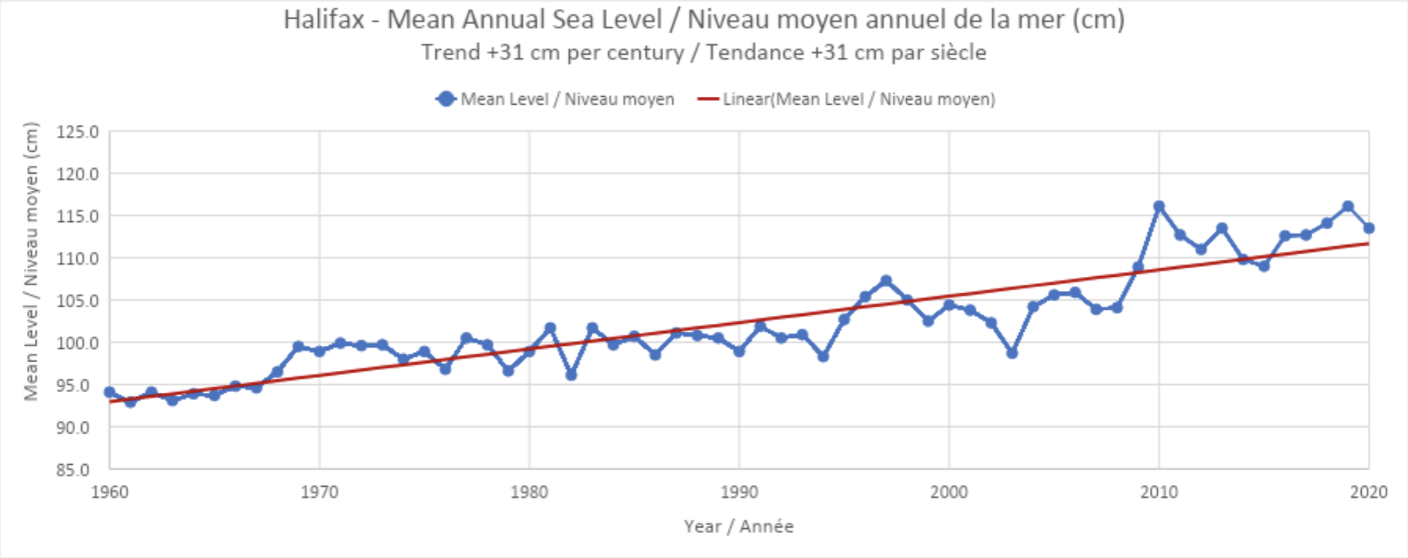
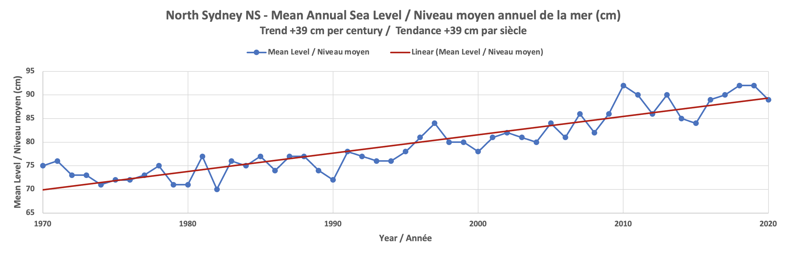
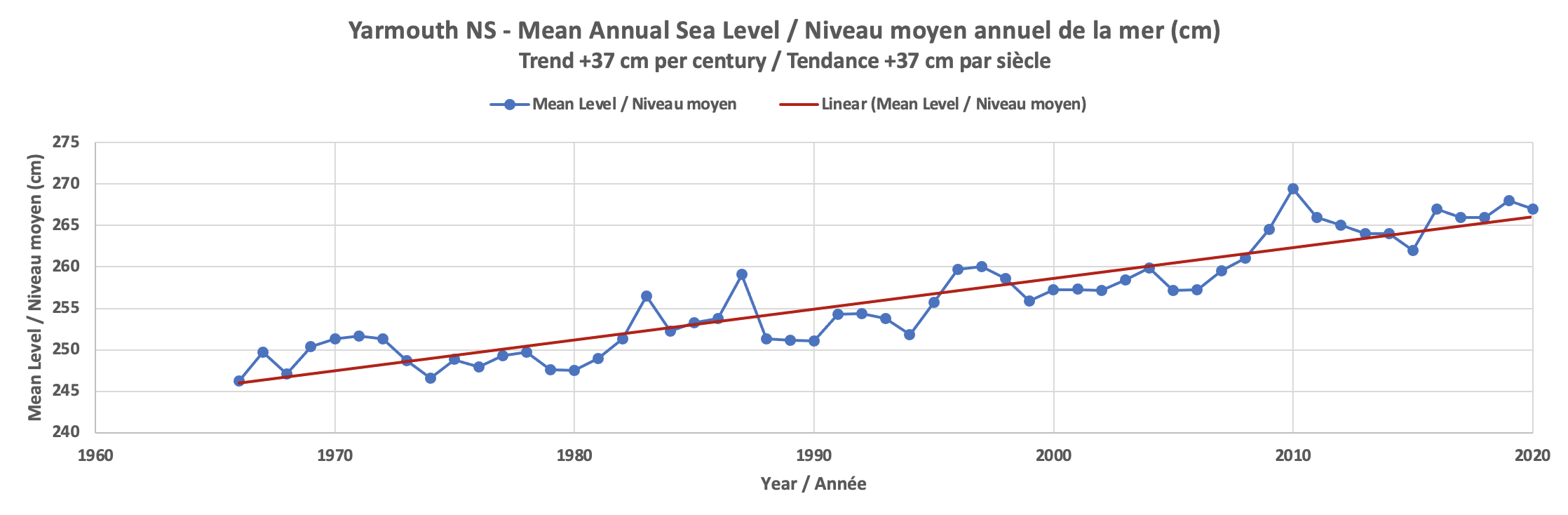
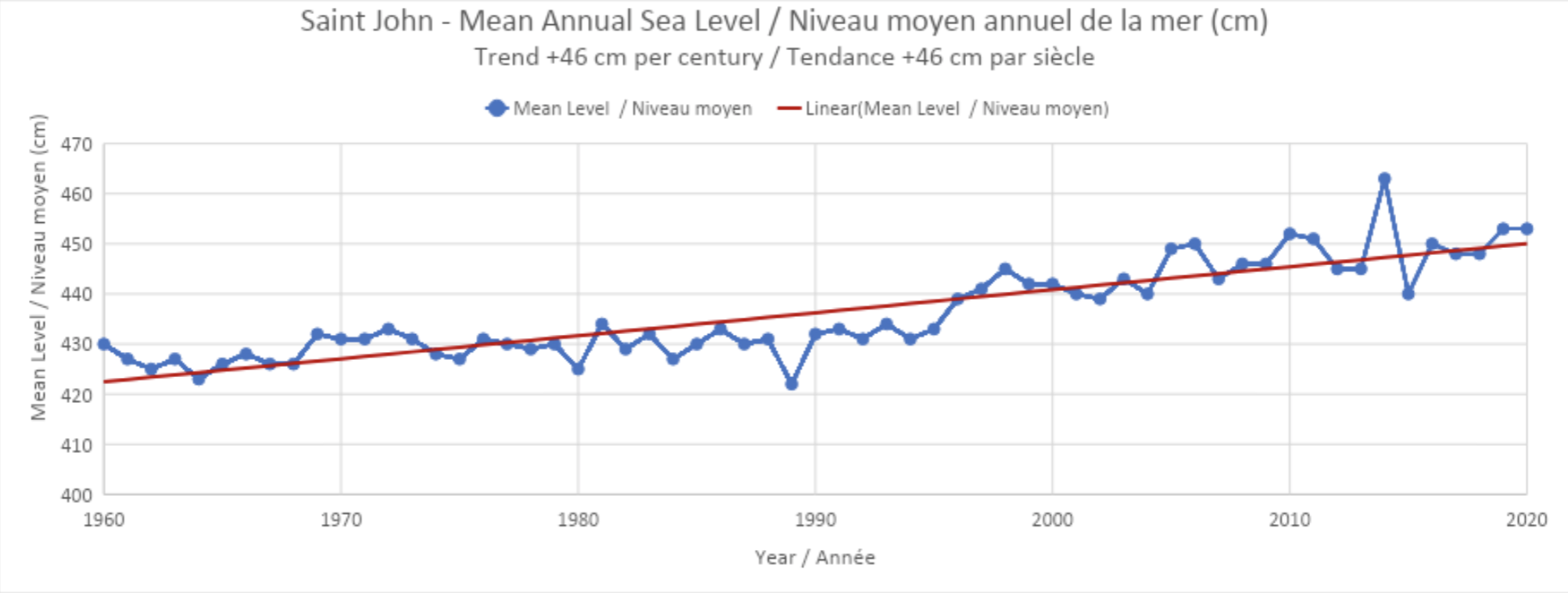
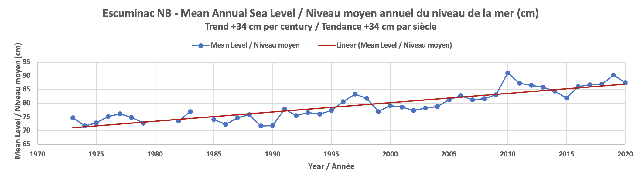
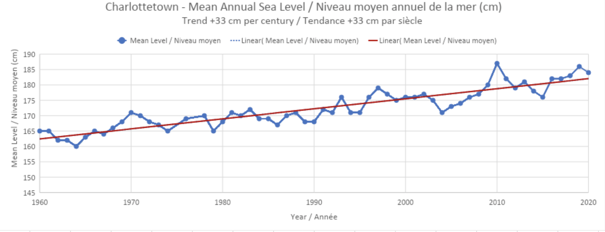
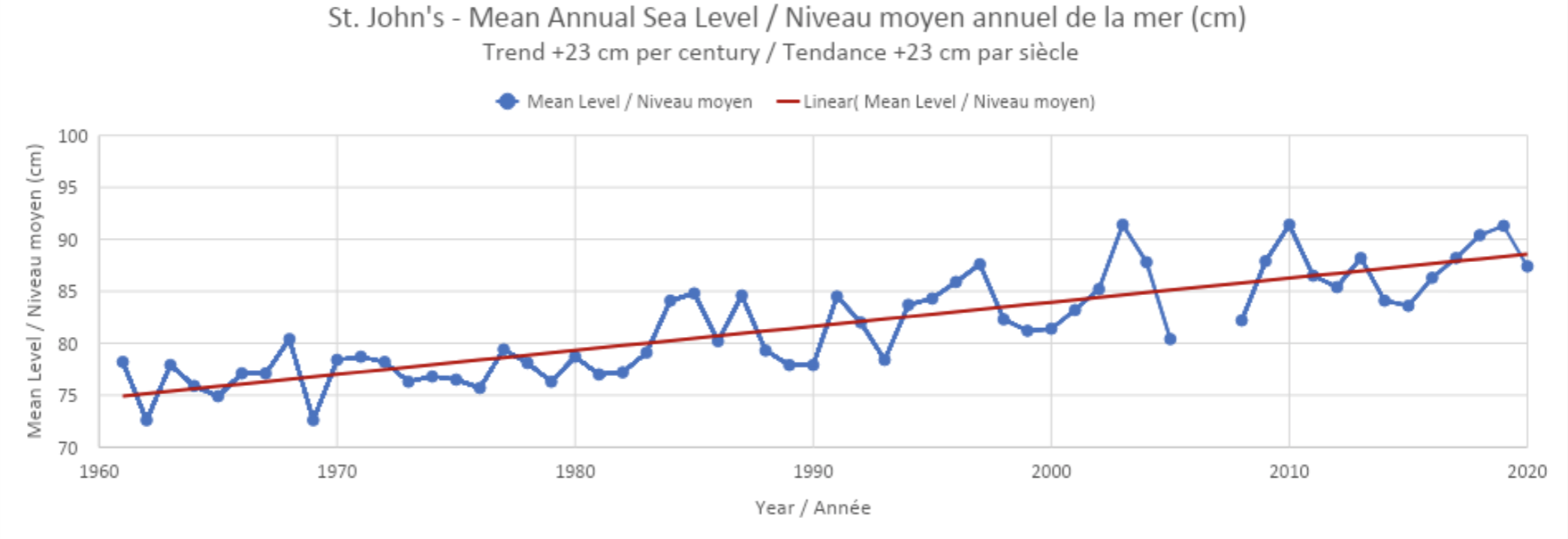
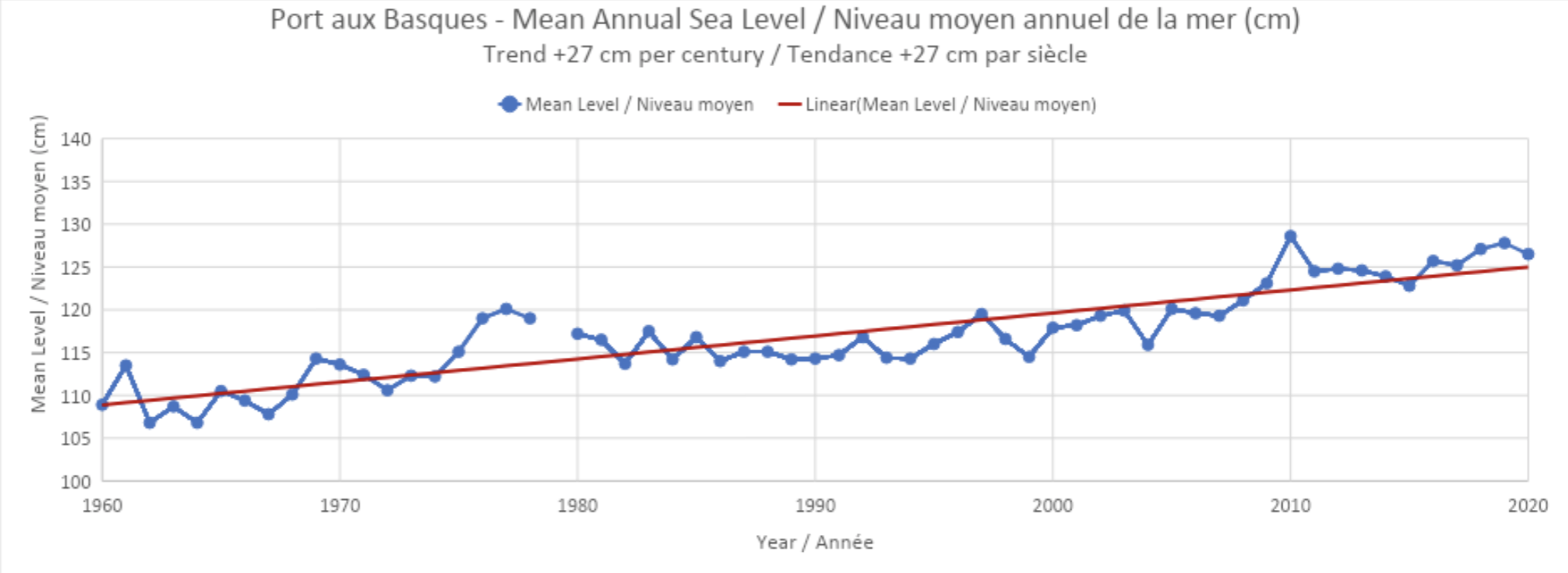
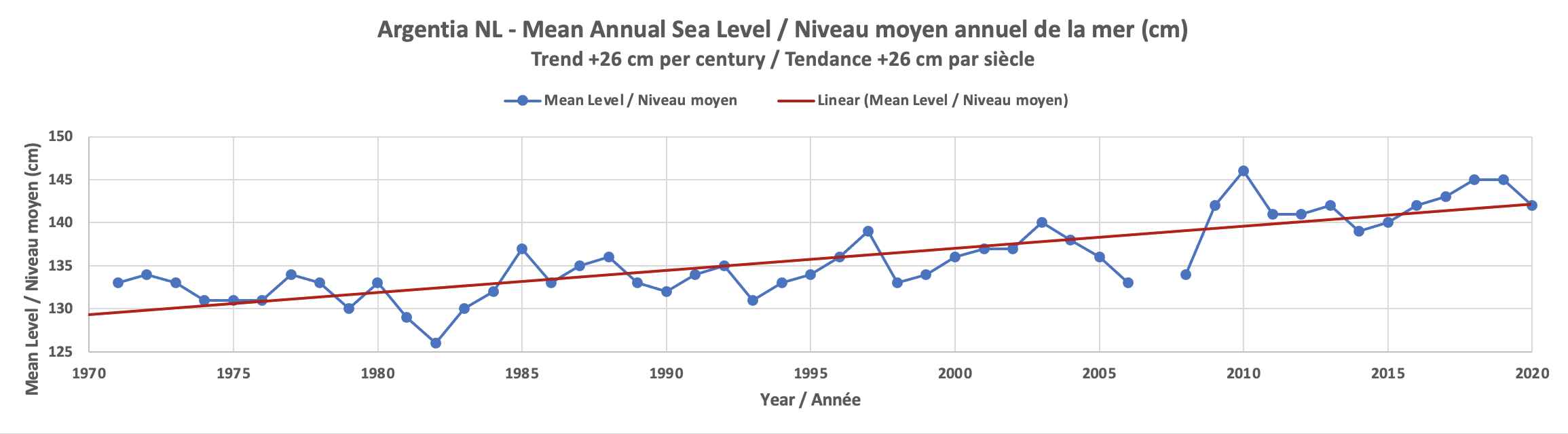
Figure Notes: Mean Sea Level data represented in these graphs is measured relative to Chart Datum (CD), the plane of vertical reference to which all charted depths on navigation charts are related and is selected so that the water level will seldom fall below it. Predicted Tide Tables are referenced to CD. Mean annual sea level data points were calculated as annual means from daily mean water levels downloaded from the Marine Environmental Data Section of Fisheries and Oceans Canada: https://www.meds-sdmm.dfo-mpo.gc.ca/isdm-gdsi/twl-mne/inventory-inventaire/index-eng.htm.
Adaptation
Coastal ecosystems, including salt marshes, vegetated dunes, and sandy beaches, can build vertically and expand laterally in response to sea-level rise, though this capacity varies across sites. These ecosystems provide important services that include coastal protection and habitat for diverse plant and animal lives. However, as a consequence of human actions that fragment wetland habitats and restrict landward migration, coastal ecosystems lose their ability to adapt to climate-induced changes and no longer act as protective barriers.
A diversity of adaptation responses to coastal impacts and risks have been implemented around the world, but mostly as a reaction to current coastal risk or experienced disasters. Hard coastal protection measures (dikes, embankments, sea walls and surge barriers) are widespread, providing predictable levels of safety in many coastal cities and towns.
Further Reading: